Camsail Bay
Introduction
The photograph on this page of Camsail Bay by Phil Williams as part of the Geograph project.
The Geograph project started in 2005 with the aim of publishing, organising and preserving representative images for every square kilometre of Great Britain, Ireland and the Isle of Man.

There are currently over 7.5m images from over 14,400 individuals and you can help contribute to the project by visiting https://www.geograph.org.uk
Camsail Bay
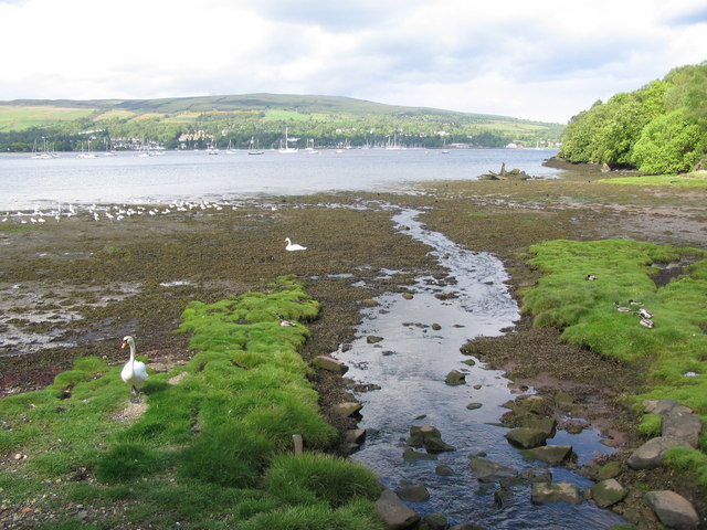
Image: © Phil Williams Taken: 28 May 2006
A view looking northeast across Camsail Bay towards Rhu Marina. The timbers to the right of the stream in the middle distance are the remains of a wooden fishing vessel which ran aground during an easterly storm in the early 1980's. I lived in Rosneath at the time and was surprised that it was never recovered as the initial damage did not appear to be too great. Perhaps the declining fortunes of the fishing industry with quotas etc, made it uneconomic.
Images are licensed for reuse under creativecommons.org/licenses/by-sa/2.0
Image Location
Latitude
56.001083
Longitude
-4.791888