Brandon Colliery Station (remains)
Introduction
The photograph on this page of Brandon Colliery Station (remains) by Ben Brooksbank as part of the Geograph project.
The Geograph project started in 2005 with the aim of publishing, organising and preserving representative images for every square kilometre of Great Britain, Ireland and the Isle of Man.

There are currently over 7.5m images from over 14,400 individuals and you can help contribute to the project by visiting https://www.geograph.org.uk
Brandon Colliery Station (remains)
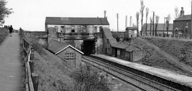
Image: © Ben Brooksbank Taken: 10 May 1965
View NE, towards Durham; ex-NER Bishop Auckland - Durham line. The station looks rather decrepit in 1965; it was closed to passengers on 4/5/64, to goods on 10/8/64; the line closed finally on 5/8/68.
Images are licensed for reuse under creativecommons.org/licenses/by-sa/2.0
Image Location
Latitude
54.749883
Longitude
-1.627731