Cut bench mark Potterhanworth school
Introduction
The photograph on this page of Cut bench mark Potterhanworth school by Brian Westlake as part of the Geograph project.
The Geograph project started in 2005 with the aim of publishing, organising and preserving representative images for every square kilometre of Great Britain, Ireland and the Isle of Man.

There are currently over 7.5m images from over 14,400 individuals and you can help contribute to the project by visiting https://www.geograph.org.uk
Cut bench mark Potterhanworth school
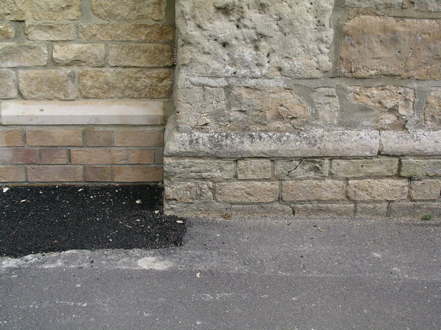
Image: © Brian Westlake Taken: 20 May 2010
Damaged cut mark on the 2nd/3rd brick courses of the north-west angle of the original school building which is now extended on the north face - see Image It is visible over the wall from the pavement. It was verified at 18.0503m above Ordnance datum in 1965. The mark is recorded on the Bench Marks database at http://www.bench-marks.org.uk/bm34508.
Images are licensed for reuse under creativecommons.org/licenses/by-sa/2.0
Image Location
Latitude
53.182538
Longitude
-0.422743