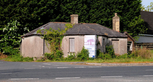
Former turnpike cottage near Dromore
Introduction
The photograph on this page of Former turnpike cottage near Dromore by Albert Bridge as part of the Geograph project.
The Geograph project started in 2005 with the aim of publishing, organising and preserving representative images for every square kilometre of Great Britain, Ireland and the Isle of Man.
There are currently over 7.5m images from over 14,400 individuals and you can help contribute to the project by visiting https://www.geograph.org.uk

Image: © Albert Bridge Taken: 31 May 2010
The former toll house is described by the “At Risk” register thus: “Planning permission has recently been given for the restoration and extension of this early-19th century building, reputed to be the last remaining turnpike cottage in Northern Ireland. It is single-storey, T-shaped in plan with a hipped slated roof and, although in a poor state of repair for a number of years, has recently been fully boarded up. It featured previously in Buildings at Risk, Vol. 1, p. 56.” It was built for the Belfast – Newry turnpike and is alongside the present Belfast – Newry/Dublin road - now a dual carriageway.

