Shellwood Road
Introduction
The photograph on this page of Shellwood Road by Ian Capper as part of the Geograph project.
The Geograph project started in 2005 with the aim of publishing, organising and preserving representative images for every square kilometre of Great Britain, Ireland and the Isle of Man.

There are currently over 7.5m images from over 14,400 individuals and you can help contribute to the project by visiting https://www.geograph.org.uk
Shellwood Road
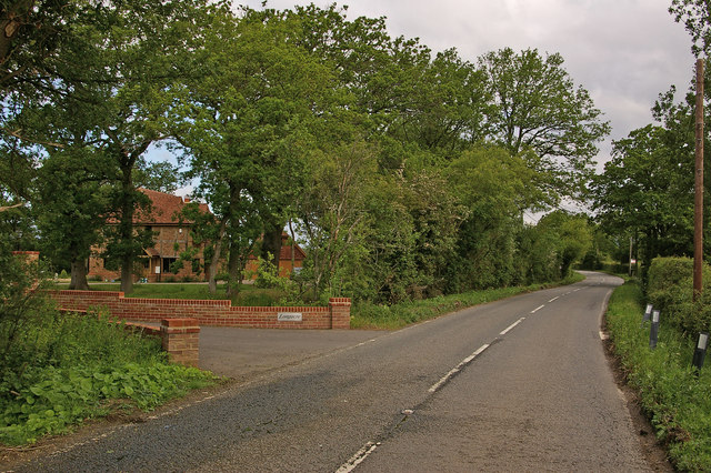
Image: © Ian Capper Taken: 30 May 2010
The house on the left, Longacre, is a recent development, replacing a previous house on the site. The previous house, thought to date from the 1930s, had become uninhabitable due to structural damage caused by the roots of nearby trees. Normally green belt rules would have meant that planning permission would only have been granted based on the same footprint as the previous house, in order to avoid encroachment on what was deemed to be open countryside. However, when planning permission was eventually granted in 2006, a compromise was reached whereby the new house was in a slightly different position, so that the trees that had caused the original problem could be retained, whilst at the same time limiting the visual intrusion that would be caused by a more substantial move within the same plot.
Images are licensed for reuse under creativecommons.org/licenses/by-sa/2.0
Image Location
Latitude
51.205009
Longitude
-0.274564