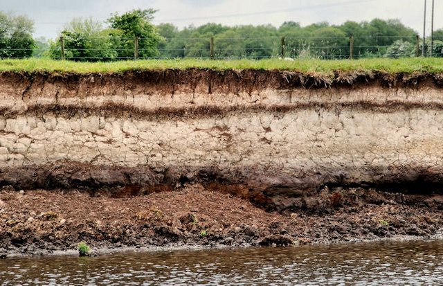
Diatomite layer near Ballymoney
Introduction
The photograph on this page of Diatomite layer near Ballymoney by Albert Bridge as part of the Geograph project.
The Geograph project started in 2005 with the aim of publishing, organising and preserving representative images for every square kilometre of Great Britain, Ireland and the Isle of Man.
There are currently over 7.5m images from over 14,400 individuals and you can help contribute to the project by visiting https://www.geograph.org.uk

Image: © Albert Bridge Taken: 29 May 2010
A selective quotation from Wikipedia “diatomite is a naturally occurring, soft, siliceous sedimentary rock that is easily crumbled into a fine white to off-white powder . . . . . natural freshwater diatomaceous earth is used in agriculture for grain storage as an anti-caking agent, as well as an insecticide. It is also used as a neutral anthelmintic (dewormer). Some farmers add it to their livestock and poultry feed to improve the health of animals. Food Grade Diatomaceous Earth is widely available in agricultural feed supply stores. It is acceptable as organic feed additive for livestock.” Documents produced by official NI bodies suggest that it occurs along the valley of the Lower Bann. This layer is on the western side of the Bann, almost opposite the confluence with the Ballymoney River.

