Chippenham, John Cole's Park
Introduction
The photograph on this page of Chippenham, John Cole's Park by Roger Templeman as part of the Geograph project.
The Geograph project started in 2005 with the aim of publishing, organising and preserving representative images for every square kilometre of Great Britain, Ireland and the Isle of Man.

There are currently over 7.5m images from over 14,400 individuals and you can help contribute to the project by visiting https://www.geograph.org.uk
Chippenham, John Cole's Park
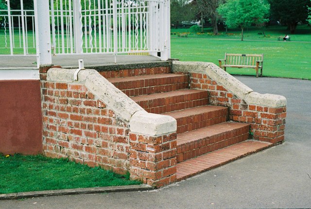
Image: © Roger Templeman Taken: 7 May 2010
Steps to bandstand in John Cole's Park, Chippenham. There is a Ordnance Survey cut mark benchmark on the 4th and 5th bricks above ground on the front of the side wall pier which was verified in 1971. It has a levelled height above Newlyn datum of 62.8127m. Additional information on this and neighbouring benchmarks can be found in the Bench Mark Database in record http://www.bench-marks.org.uk/bm34254.
Images are licensed for reuse under creativecommons.org/licenses/by-sa/2.0
Image Location
Latitude
51.465627
Longitude
-2.121448