Former railway bridge, Glynneath
Introduction
The photograph on this page of Former railway bridge, Glynneath by Jaggery as part of the Geograph project.
The Geograph project started in 2005 with the aim of publishing, organising and preserving representative images for every square kilometre of Great Britain, Ireland and the Isle of Man.

There are currently over 7.5m images from over 14,400 individuals and you can help contribute to the project by visiting https://www.geograph.org.uk
Former railway bridge, Glynneath
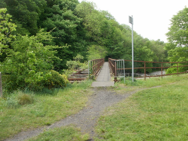
Image: © Jaggery Taken: 26 May 2010
The view from the north bank of the River Neath across a bridge that formerly carried a spur of the Vale of Neath Railway. A fragment http://www.geograph.org.uk/photo/1880893 of rail track can be seen on the left edge of the bridge. I didn't notice the sign on the right side of the bridge (it's facing the wrong way). Here's the matching sign http://www.geograph.org.uk/photo/1880904 on the other side of the bridge.
Images are licensed for reuse under creativecommons.org/licenses/by-sa/2.0
Image Location
Latitude
51.743292
Longitude
-3.622144