Buchanan Castle, Drymen
Introduction
The photograph on this page of Buchanan Castle, Drymen by Elliott Simpson as part of the Geograph project.
The Geograph project started in 2005 with the aim of publishing, organising and preserving representative images for every square kilometre of Great Britain, Ireland and the Isle of Man.

There are currently over 7.5m images from over 14,400 individuals and you can help contribute to the project by visiting https://www.geograph.org.uk
Buchanan Castle, Drymen
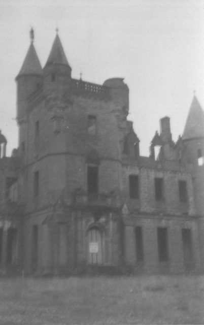
Image: © Elliott Simpson Taken: Unknown
The castle was used during World War II as a hospital - see http://en.wikipedia.org/wiki/Buchanan_Castle - and, when I visited it in my teens in 1960, there were still the remains of bed frames among the ruins.
Images are licensed for reuse under creativecommons.org/licenses/by-sa/2.0
Image Location
Latitude
56.065437
Longitude
-4.471988