Cycling club, Bangor
Introduction
The photograph on this page of Cycling club, Bangor by Rossographer as part of the Geograph project.
The Geograph project started in 2005 with the aim of publishing, organising and preserving representative images for every square kilometre of Great Britain, Ireland and the Isle of Man.

There are currently over 7.5m images from over 14,400 individuals and you can help contribute to the project by visiting https://www.geograph.org.uk
Cycling club, Bangor
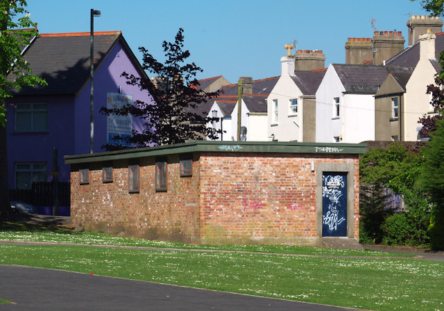
Image: © Rossographer Taken: 23 May 2010
This old brick building which sits on the edge of Ward Park beside Park Drive has, for many years, been home to North Down Cycling Club http://www.northdowncc.com/ . The building is a converted WW2 air raid shelter - see http://ww2ni.webs.com/countydownpart4.htm and Image
Images are licensed for reuse under creativecommons.org/licenses/by-sa/2.0
Image Location
Latitude
54.66047
Longitude
-5.662602