Fetternear House
Introduction
The photograph on this page of Fetternear House by Mike Searle as part of the Geograph project.
The Geograph project started in 2005 with the aim of publishing, organising and preserving representative images for every square kilometre of Great Britain, Ireland and the Isle of Man.

There are currently over 7.5m images from over 14,400 individuals and you can help contribute to the project by visiting https://www.geograph.org.uk
Fetternear House
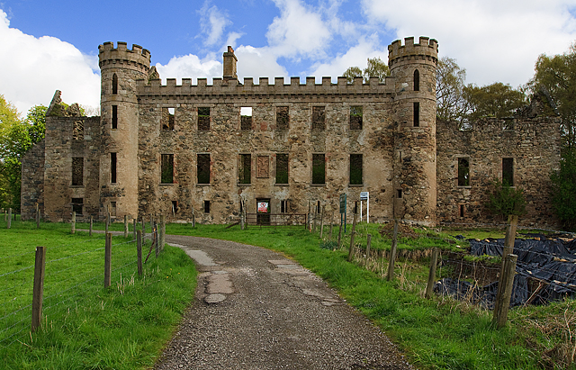
Image: © Mike Searle Taken: 12 May 2010
The main parts of the former Leslie mansion and in particular the frontage date from the late C17, whilst the east wing to the right is a rebuild of 1570, after the estate had been gifted to the Leslie family in 1566. The battlemented features, and the west wing to the left, date from 1818-19 and 1841-44 respectively. The black plastic sheeting on the right are coverings for the ongoing archaeological dig.
Images are licensed for reuse under creativecommons.org/licenses/by-sa/2.0
Image Location
Latitude
57.243668
Longitude
-2.460284