Blairfindy Castle
Introduction
The photograph on this page of Blairfindy Castle by Mike Searle as part of the Geograph project.
The Geograph project started in 2005 with the aim of publishing, organising and preserving representative images for every square kilometre of Great Britain, Ireland and the Isle of Man.

There are currently over 7.5m images from over 14,400 individuals and you can help contribute to the project by visiting https://www.geograph.org.uk
Blairfindy Castle
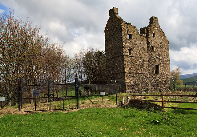
Image: © Mike Searle Taken: 7 May 2010
This fortified tower house was completed in 1564 by John Gordon of the Huntly family. An L-plan castle, it was designed to cover all four walls with defensive fire should the need arise. In 1589 Blairfindy passed into the hands of the Earls of Huntly who appropriately used it as a hunting seat. In 1647 during the Civil War the second Marquis of Huntly, a Royalist, was captured near Tomintoul by Parliamentary forces, and was imprisoned in Blairfindy before being tried and executed in Edinburgh. The castle is in a dangerous condition and access beyond the fence is not permitted.
Images are licensed for reuse under creativecommons.org/licenses/by-sa/2.0
Image Location
Latitude
57.341284
Longitude
-3.333756