The site of Daybrook Junction
Introduction
The photograph on this page of The site of Daybrook Junction by John Sutton as part of the Geograph project.
The Geograph project started in 2005 with the aim of publishing, organising and preserving representative images for every square kilometre of Great Britain, Ireland and the Isle of Man.

There are currently over 7.5m images from over 14,400 individuals and you can help contribute to the project by visiting https://www.geograph.org.uk
The site of Daybrook Junction
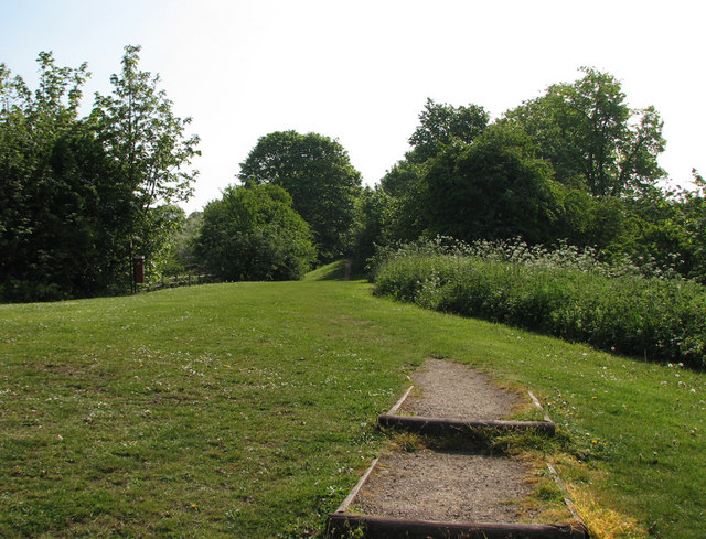
Image: © John Sutton Taken: 18 May 2010
Until 1960, the path straight ahead was the track of the Great Northern Railway's line to Derby, always known as The Back Line as it circled Nottingham to the east, carrying Erewash Valley coal to the marshalling yards at Colwick. The short-lived Nottingham Suburban Railway, whose passenger service lasted only from 1889-1931, but which remained open until 1951 to serve Mapperley brickworks, diverged on an embankment to the right, passing through Woodthorpe Grange Park and serving stations at Sherwood, St Ann's Well and Thorneywood before joining the Grantham line at Trent Lane Junction, trains terminating at London Road. Its course through Woodthorpe is marked by the curve of Worcester Road, while further south the almost appropriately-named Raibank Gardens is built on the trackbed. Daybrook B&Q, behind the camera, stands where the two lines actually joined. Most of the embankment there has been levelled (and the bridge over Mansfield Road removed), so the steps in the foreground lead up to what used to be rail level.
Images are licensed for reuse under creativecommons.org/licenses/by-sa/2.0
Image Location
Latitude
52.99487
Longitude
-1.136426