Cinderhill Tram Stop - 1
Introduction
The photograph on this page of Cinderhill Tram Stop - 1 by John Sutton as part of the Geograph project.
The Geograph project started in 2005 with the aim of publishing, organising and preserving representative images for every square kilometre of Great Britain, Ireland and the Isle of Man.

There are currently over 7.5m images from over 14,400 individuals and you can help contribute to the project by visiting https://www.geograph.org.uk
Cinderhill Tram Stop - 1
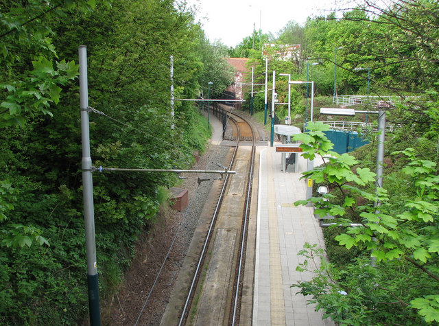
Image: © John Sutton Taken: 19 May 2010
The Highbury Vale to Phoenix Park branch of the Nottingham tram system is built on the formation of the Midland Railway Babbington (Cinderhill) Colliery Branch, which ran from a junction with the Midland's Nottingham to Mansfield and Worksop line where the Highbury Vale tram stop now is. The Midland line ran parallel to (and in the shadow of) the Great Northern Derbyshire Extension line to Derby, which ran on tall embankments and viaducts - now completely gone - between Cinderhill and Basford North. This view is taken from the Midland Railway bridge carrying Bagnall Road, looking across the tram stop towards Great Northern Bridge No 3, which carried the Cinderhill to Bulwell road over the lines leading to the colliery sidings. To the right of here, where there are now steps and a zig-zag pedestrian ramp, there was once a railway junction where the Great Northern Babbington Colliery line joined the Midland. The GNR cutting has been filled in, but the parapets of GNR Bridge No 2, on Bagnall Road, survive.
Images are licensed for reuse under creativecommons.org/licenses/by-sa/2.0
Image Location
Latitude
52.988668
Longitude
-1.200904