Glasshouse Common tramroad
Introduction
The photograph on this page of Glasshouse Common tramroad by Alan Murray-Rust as part of the Geograph project.
The Geograph project started in 2005 with the aim of publishing, organising and preserving representative images for every square kilometre of Great Britain, Ireland and the Isle of Man.

There are currently over 7.5m images from over 14,400 individuals and you can help contribute to the project by visiting https://www.geograph.org.uk
Glasshouse Common tramroad
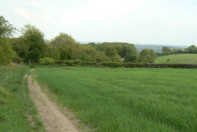
Image: © Alan Murray-Rust Taken: 18 May 2010
A public footpath follows the line of the tramroad which connected the ironstone mines on the Common to the Chesterfield Canal. In this view, looking south-east towards New Whittington, its line follows the line of trees round in a gentle S-curve, passing alongside the area of mature woodland just right of centre.
Images are licensed for reuse under creativecommons.org/licenses/by-sa/2.0
Image Location


Leaflet Map data © OpenStreetMap
Latitude
53.283647
Longitude
-1.408852