Bovey, for Ilsington Station (remains)
Introduction
The photograph on this page of Bovey, for Ilsington Station (remains) by Ben Brooksbank as part of the Geograph project.
The Geograph project started in 2005 with the aim of publishing, organising and preserving representative images for every square kilometre of Great Britain, Ireland and the Isle of Man.

There are currently over 7.5m images from over 14,400 individuals and you can help contribute to the project by visiting https://www.geograph.org.uk
Bovey, for Ilsington Station (remains)
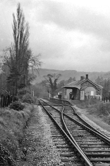
Image: © Ben Brooksbank Taken: 20 Apr 1964
View northward, towards Moretonhampstead; ex-GWR (Newton Abbot) - Heathfield - Moretonhampstead branch. The station and the service to Moretonhampstead was closed on 2/3/59 (goods 6/4/64, but oil was brought to Bovey from Heathfield until 4/5/70). The station - 'Tracey' in the name - seemed to be still well-preserved in 1964.
Images are licensed for reuse under creativecommons.org/licenses/by-sa/2.0
Image Location
Latitude
50.59174
Longitude
-3.681408