Line of tramroad
Introduction
The photograph on this page of Line of tramroad by Alan Murray-Rust as part of the Geograph project.
The Geograph project started in 2005 with the aim of publishing, organising and preserving representative images for every square kilometre of Great Britain, Ireland and the Isle of Man.

There are currently over 7.5m images from over 14,400 individuals and you can help contribute to the project by visiting https://www.geograph.org.uk
Line of tramroad
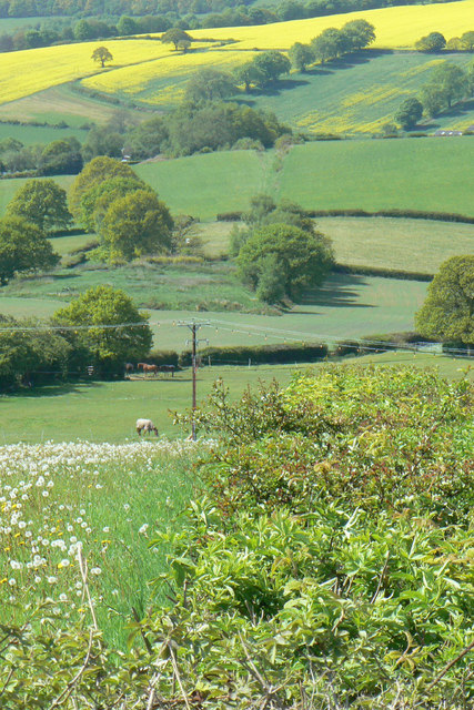
Image: © Alan Murray-Rust Taken: 18 May 2010
The hedge in the foreground, the line of trees in the middle distance and the groove through the field beyond all mark the line of the tramroad which used to connect Apperknowle Colliery (behind the photographer) to the railway line in the valley at Unstone. The colliery operated briefly in the 1890s.
Images are licensed for reuse under creativecommons.org/licenses/by-sa/2.0
Image Location
Latitude
53.300308
Longitude
-1.43383