Wattons Ford
Introduction
The photograph on this page of Wattons Ford by Mike Faherty as part of the Geograph project.
The Geograph project started in 2005 with the aim of publishing, organising and preserving representative images for every square kilometre of Great Britain, Ireland and the Isle of Man.

There are currently over 7.5m images from over 14,400 individuals and you can help contribute to the project by visiting https://www.geograph.org.uk
Wattons Ford
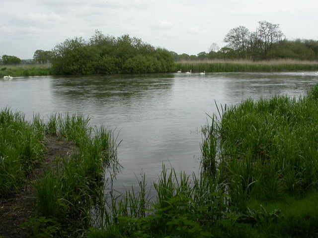
Image: © Mike Faherty Taken: 19 May 2010
Across the Avon. OS shows the byway crossing the river here; at first sight, risky, but there are swans standing in the middle of the river a few metres downstream, so it is obviously not as deep as it appears. For recent successful attempts, see http://www.wetroads.co.uk/hampshire.htm
Images are licensed for reuse under creativecommons.org/licenses/by-sa/2.0
Image Location


Leaflet Map data © OpenStreetMap
Latitude
50.815228
Longitude
-1.806761