Shortwood Close
Introduction
The photograph on this page of Shortwood Close by Alan Murray-Rust as part of the Geograph project.
The Geograph project started in 2005 with the aim of publishing, organising and preserving representative images for every square kilometre of Great Britain, Ireland and the Isle of Man.

There are currently over 7.5m images from over 14,400 individuals and you can help contribute to the project by visiting https://www.geograph.org.uk
Shortwood Close
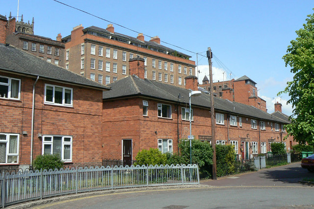
Image: © Alan Murray-Rust Taken: 17 May 2010
This and the neighbouring housing on Cliff Road are an inter-war development of local authority housing tucked under the sandstone cliff on which the Lace Market area of Nottingham - the old Saxon town - stands. The buildings behind are built on the cliff and do not stretch down to the same ground level.
Images are licensed for reuse under creativecommons.org/licenses/by-sa/2.0
Image Location
Latitude
52.949973
Longitude
-1.143422