Site of Balderton Station
Introduction
The photograph on this page of Site of Balderton Station by Ben Brooksbank as part of the Geograph project.
The Geograph project started in 2005 with the aim of publishing, organising and preserving representative images for every square kilometre of Great Britain, Ireland and the Isle of Man.

There are currently over 7.5m images from over 14,400 individuals and you can help contribute to the project by visiting https://www.geograph.org.uk
Site of Balderton Station
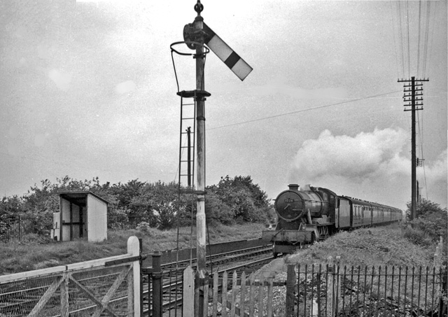
Image: © Ben Brooksbank Taken: 21 May 1961
View NE, towards Chester; ex-GWR Shrewsbury - Chester main line. This station had been closed on 3/3/52. It remained open for goods until 1/11/64, although this is not apparent from the photograph, which shows a typical GWR Up express (headed by a 'County' class 4-6-0) and GWR lower-quadrant signal.
Images are licensed for reuse under creativecommons.org/licenses/by-sa/2.0
Image Location
Latitude
53.153793
Longitude
-2.935617