Halfway House pub sign, 435 Manchester Road
Introduction
The photograph on this page of Halfway House pub sign, 435 Manchester Road by P L Chadwick as part of the Geograph project.
The Geograph project started in 2005 with the aim of publishing, organising and preserving representative images for every square kilometre of Great Britain, Ireland and the Isle of Man.

There are currently over 7.5m images from over 14,400 individuals and you can help contribute to the project by visiting https://www.geograph.org.uk
Halfway House pub sign, 435 Manchester Road
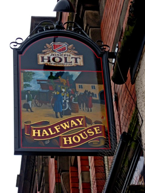
Image: © P L Chadwick Taken: 2 May 2010
The name apparently originates from the pub's location approximately halfway between Manchester and Ashton-under-Lyne. The sign shows a horse-drawn coach outside a building which doesn't look remotely like the present one. Maybe this was the original pub? It's interesting to reflect on the changes in public transport running along this road over the past 200 years - horse-drawn coaches, double-deck trams, electric trolleybuses, motor buses and from early 2012 modern single-deck articulated trams. Image Image
Images are licensed for reuse under creativecommons.org/licenses/by-sa/2.0
Image Location
Latitude
53.480765
Longitude
-2.166767