"Junction on bend" sign near Killyleagh
Introduction
The photograph on this page of "Junction on bend" sign near Killyleagh by Albert Bridge as part of the Geograph project.
The Geograph project started in 2005 with the aim of publishing, organising and preserving representative images for every square kilometre of Great Britain, Ireland and the Isle of Man.

There are currently over 7.5m images from over 14,400 individuals and you can help contribute to the project by visiting https://www.geograph.org.uk
"Junction on bend" sign near Killyleagh
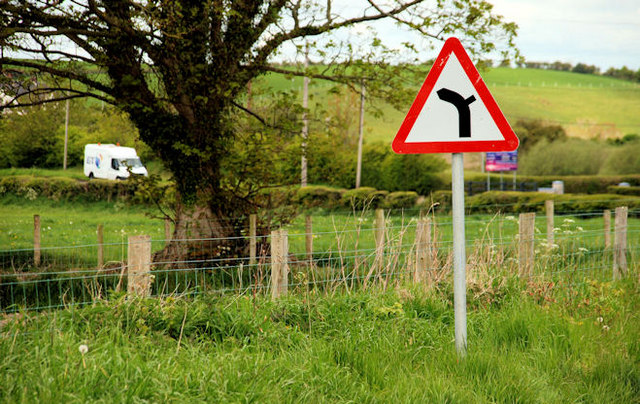
Image: © Albert Bridge Taken: 17 May 2010
On the Clea Lough Road Image (looking towards Derryboye). The road to the right is the Tullymacnous Road Image The position of the BT van, in relation to the sign, gives an indication of the bend’s curve.
Images are licensed for reuse under creativecommons.org/licenses/by-sa/2.0
Image Location
Latitude
54.414377
Longitude
-5.668467