35 Tooting Bec Gardens
Introduction
The photograph on this page of 35 Tooting Bec Gardens by Stephen Richards as part of the Geograph project.
The Geograph project started in 2005 with the aim of publishing, organising and preserving representative images for every square kilometre of Great Britain, Ireland and the Isle of Man.

There are currently over 7.5m images from over 14,400 individuals and you can help contribute to the project by visiting https://www.geograph.org.uk
35 Tooting Bec Gardens
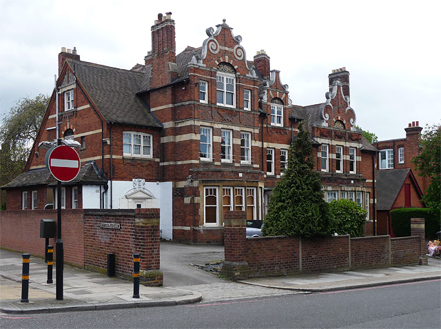
Image: © Stephen Richards Taken: Unknown
A florid affair with some remarkable gables adorned with scrolls and volutes. The fenestration is unusual too, with the upper panes divided by a curved glazing bar and the section above divided into three smaller panes by mullions. Like many such houses it is now sub-divided into flats. One of a number of large houses near Tooting Bec Common dating from the late C19th/early C20th.
Images are licensed for reuse under creativecommons.org/licenses/by-sa/2.0
Image Location
Latitude
51.429975
Longitude
-0.133538