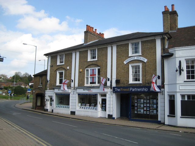
Chalfont St Peter: Bridge House
Introduction
The photograph on this page of Chalfont St Peter: Bridge House by Nigel Cox as part of the Geograph project.
The Geograph project started in 2005 with the aim of publishing, organising and preserving representative images for every square kilometre of Great Britain, Ireland and the Isle of Man.
There are currently over 7.5m images from over 14,400 individuals and you can help contribute to the project by visiting https://www.geograph.org.uk

Image: © Nigel Cox Taken: 25 Apr 2010
Bridge House is a Grade II Listed Building on the High Street where it crosses the River Misbourne. The English Heritage Listed Building reference page describes it thus: "Mid C19 three bay, three storey. Yellow stock brick with stucco cornice, pilasters and channelled rustication to ground floor. Recessed barred sashes, 1st floor windows in arched recesses. Architraved to all but centre bay 1st floor. Modern shop fronts. Left hand door and original channelled rustication. Two storey one bay wing at left. Hipped slate roof."

