Bordon Station, approach
Introduction
The photograph on this page of Bordon Station, approach by Ben Brooksbank as part of the Geograph project.
The Geograph project started in 2005 with the aim of publishing, organising and preserving representative images for every square kilometre of Great Britain, Ireland and the Isle of Man.

There are currently over 7.5m images from over 14,400 individuals and you can help contribute to the project by visiting https://www.geograph.org.uk
Bordon Station, approach
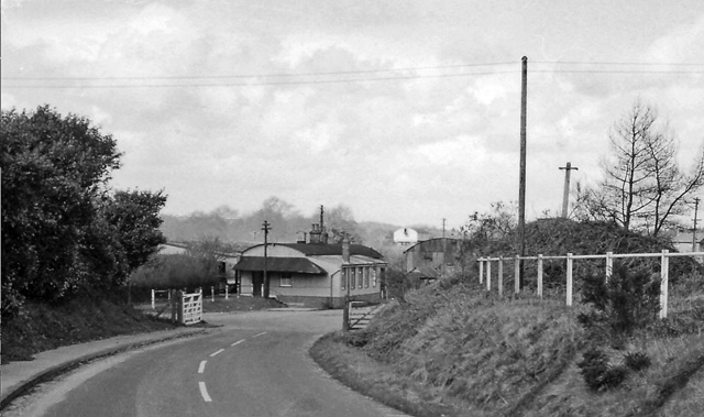
Image: © Ben Brooksbank Taken: 18 Apr 1963
View northward to station entrance. This was the terminus of the ex-LSW branch from Bordon, also the northern end of the Longmoor Military Railway complex. It closed to passengers on 16/9/57, to goods on 4/4/66. Photos of the station, before and after closure, with some historical information on the lines in that area, can be found at http://www.disused-stations.org.uk/b/bordon/index.shtml
Images are licensed for reuse under creativecommons.org/licenses/by-sa/2.0
Image Location
Latitude
51.119919
Longitude
-0.881928