Melbourne Park: where there was once a busy railway
Introduction
The photograph on this page of Melbourne Park: where there was once a busy railway by John Sutton as part of the Geograph project.
The Geograph project started in 2005 with the aim of publishing, organising and preserving representative images for every square kilometre of Great Britain, Ireland and the Isle of Man.

There are currently over 7.5m images from over 14,400 individuals and you can help contribute to the project by visiting https://www.geograph.org.uk
Melbourne Park: where there was once a busy railway
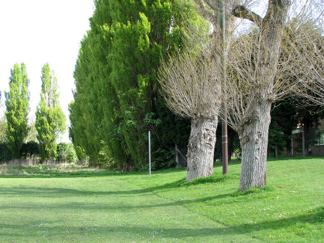
Image: © John Sutton Taken: 11 May 2010
The almost imperceptible embankment to the right of the pollarded poplars in the foreground marks the shunting neck of the National Coal Board railway line which connected Babbington (Cinderhill) Colliery with the extensive fan of sidings at the Nuthall Road landsale wharf, which lay behind the green poplars, where the Staindale Drive housing development now stands. This railway had originally been built by Thomas North, the colliery owner, to connect Babbington to the Nottingham Canal, due south at Wollaton Road, and later the Midland Railway line from Radford to Trowell at Babbington Sidings, near where Western Boulevard Bridge now stands. The line south of Melbourne Park had been long abandoned (since the building of Western Boulevard in the 1930s) by the time I sat on the swings just out of picture to the left and watched a little green locomotive named Peter shunting NCB East Midlands Division No 6 Area wagons, which were black with white lettering and bright yellow corner ironwork. The line of the railway can still be made out near where it crosses Melbourne Road a little way north of here - see Image
Images are licensed for reuse under creativecommons.org/licenses/by-sa/2.0
Image Location
Latitude
52.971873
Longitude
-1.189748