Melbourne Park: poplars which once bordered a railway
Introduction
The photograph on this page of Melbourne Park: poplars which once bordered a railway by John Sutton as part of the Geograph project.
The Geograph project started in 2005 with the aim of publishing, organising and preserving representative images for every square kilometre of Great Britain, Ireland and the Isle of Man.

There are currently over 7.5m images from over 14,400 individuals and you can help contribute to the project by visiting https://www.geograph.org.uk
Melbourne Park: poplars which once bordered a railway
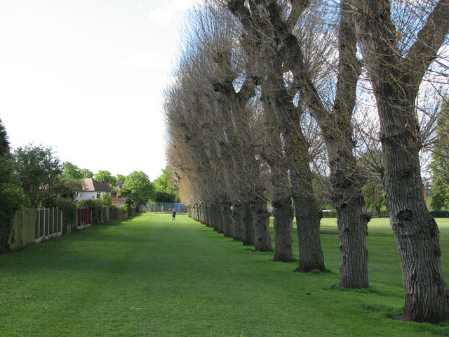
Image: © John Sutton Taken: 11 May 2010
This view, from near the Newlyn Gardens entrance to the park, shows what in my childhood in the 1950s was the shunting neck of the National Coal Board railway line which connected Babbington (Cinderhill) Colliery with the sidings at the Nuthall Road landsale wharf (some way behind the camera). This railway had originally been built by Thomas North, the colliery owner, to connect Babbington to the Nottingham Canal, due south at Wollaton Road, and later the Midland Railway line from Radford to Trowell at Babbington Sidings, near where Western Boulevard bridge now stands. The line south of Melbourne Park had been long abandoned (since the building of Western Boulevard in the 1930s) by the time I watched a little green locomotive named Peter shunting NCB East Midlands Division No 6 Area wagons, which were black with white lettering and bright yellow corner ironwork.
Images are licensed for reuse under creativecommons.org/licenses/by-sa/2.0
Image Location
Latitude
52.970708
Longitude
-1.190365