Boosbeck Station
Introduction
The photograph on this page of Boosbeck Station by Ben Brooksbank as part of the Geograph project.
The Geograph project started in 2005 with the aim of publishing, organising and preserving representative images for every square kilometre of Great Britain, Ireland and the Isle of Man.

There are currently over 7.5m images from over 14,400 individuals and you can help contribute to the project by visiting https://www.geograph.org.uk
Boosbeck Station
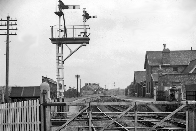
Image: © Ben Brooksbank Taken: 19 Apr 1961
View NE, towards Brotton; ex-NER Middlesbrough - Guisborough - Brotton line. The station closed to passengers on 2/5/60, with the service from Middlesbrough being curtailed to Guisborough, but goods traffic continued through Boosbeck to Brotton until 12/9/64.
Images are licensed for reuse under creativecommons.org/licenses/by-sa/2.0
Image Location
Latitude
54.545144
Longitude
-0.98236