Ruins of Llanstinan House
Introduction
The photograph on this page of Ruins of Llanstinan House by Natasha Ceridwen de Chroustchoff as part of the Geograph project.
The Geograph project started in 2005 with the aim of publishing, organising and preserving representative images for every square kilometre of Great Britain, Ireland and the Isle of Man.

There are currently over 7.5m images from over 14,400 individuals and you can help contribute to the project by visiting https://www.geograph.org.uk
Ruins of Llanstinan House
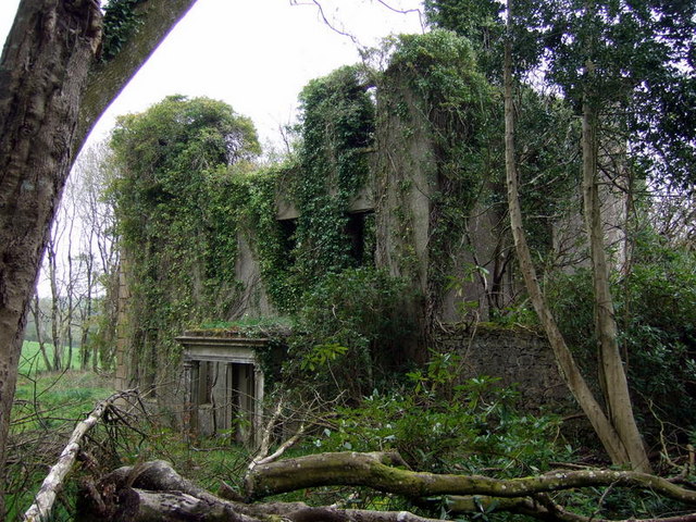
Image: © Natasha Ceridwen de Chroustchoff Taken: 5 May 2010
Showing ivy growth shrouding the derelict structure and some of the overgrown shrubs and trees that may be what remains of ornamental planting. A high wall extends from the right of the building and continues up along the side of the garden.
Images are licensed for reuse under creativecommons.org/licenses/by-sa/2.0
Image Location
Latitude
51.950255
Longitude
-4.980111