Outbuilding of Stocking Farm
Introduction
The photograph on this page of Outbuilding of Stocking Farm by Richard Law as part of the Geograph project.
The Geograph project started in 2005 with the aim of publishing, organising and preserving representative images for every square kilometre of Great Britain, Ireland and the Isle of Man.

There are currently over 7.5m images from over 14,400 individuals and you can help contribute to the project by visiting https://www.geograph.org.uk
Outbuilding of Stocking Farm
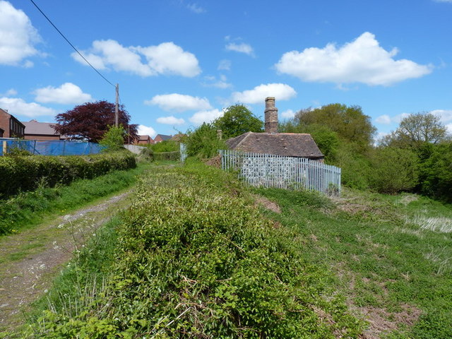
Image: © Richard Law Taken: 9 May 2010
Stocking Farm was one of three farms in the Lightmoor area, left undeveloped by Telford until 2009 or 2010. The main farm buildings are now in the process of conversion and improvement (2010), but I don't rate the chances of this small cottage lasting too long. Update August 2020. It turns out I was completely wrong at that front, as the tiny building is in reality a rare survival of a late 18th century squatter's cottage, dated to 1797, and built by a local miner called Robert Bayley, earning himself a 6d fine for "an encroachment upon the Lord's waste". It was Grade II listed https://britishlistedbuildings.co.uk/101030945-squatters-cottage-at-national-grid-reference-sj6764105978-dawley-hamlets#.X0KTkMhKjcs & https://historicengland.org.uk/listing/the-list/list-entry/1030945 in 1992, and has recently been restored from a rather dilapidated condition to become a community education facility, hosting courses and small displays by the local school and Shropshire Wildlife Trust.
Images are licensed for reuse under creativecommons.org/licenses/by-sa/2.0
Image Location
Latitude
52.65049
Longitude
-2.479464