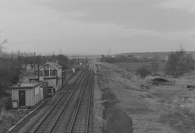
Wath Central Signal Box Mid 1980's
Introduction
The photograph on this page of Wath Central Signal Box Mid 1980's by John Ambler as part of the Geograph project.
The Geograph project started in 2005 with the aim of publishing, organising and preserving representative images for every square kilometre of Great Britain, Ireland and the Isle of Man.
There are currently over 7.5m images from over 14,400 individuals and you can help contribute to the project by visiting https://www.geograph.org.uk

Image: © John Ambler Taken: Unknown
Wath Central signal box photographed in the mid-1980's after the railway had been reduced from 4 tracks to 2. In the distance is Moor Road Bridge carrying the road to Wath Main Colliery - the "Blue Bridge" is currently very close to the site of this bridge. Beyond the bridge is Wath Hump marshalling yard opened 1907 by the Great Central Railway, and Wath loco shed, eastern terminus of the former LNER electric railway (Manchester, Sheffield & Wath electrification scheme) started pre-WW2 but not finished until the early 1950's. The bridge from which the photograph was taken was demolished c2008.

