Lifting bridge, Redriff Road
Introduction
The photograph on this page of Lifting bridge, Redriff Road by Malc McDonald as part of the Geograph project.
The Geograph project started in 2005 with the aim of publishing, organising and preserving representative images for every square kilometre of Great Britain, Ireland and the Isle of Man.

There are currently over 7.5m images from over 14,400 individuals and you can help contribute to the project by visiting https://www.geograph.org.uk
Lifting bridge, Redriff Road
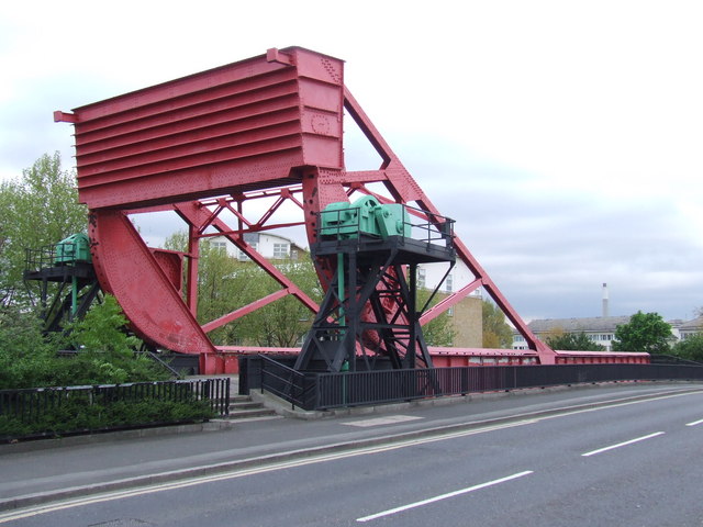
Image: © Malc McDonald Taken: 10 May 2010
The old lifting bridge which used to carry Redriff Road between the docks at Surrey Docks.
Images are licensed for reuse under creativecommons.org/licenses/by-sa/2.0
Image Location
Latitude
51.494082
Longitude
-0.044628