The Covenanters' Cave near Cargenbridge
Introduction
The photograph on this page of The Covenanters' Cave near Cargenbridge by Walter Baxter as part of the Geograph project.
The Geograph project started in 2005 with the aim of publishing, organising and preserving representative images for every square kilometre of Great Britain, Ireland and the Isle of Man.

There are currently over 7.5m images from over 14,400 individuals and you can help contribute to the project by visiting https://www.geograph.org.uk
The Covenanters' Cave near Cargenbridge
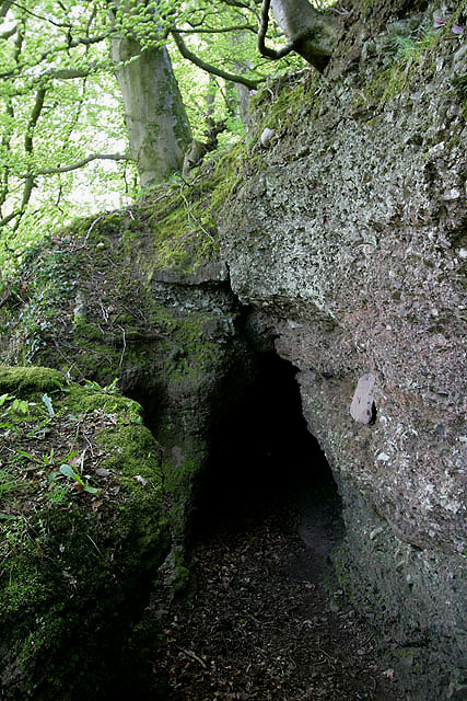
Image: © Walter Baxter Taken: 8 May 2010
This small cave is located to the southeast of Cargenbridge in Conhuith Plantation on steep ground overlooking the Cargen Water. The entrance is approximately 800mm wide by 1.4m high and tapers back in width and height for about 2.5m. The cave would be capable of hiding a few men in the time of the Covenanters when Presbyterians were persecuted by government soldiers for their religious beliefs. I had an interesting encounter here with fellow geographer Darrin Antrobus who was photographing the same cave. He is the first geographer I have met by chance since I joined Geograph in July 2006 and although the odds must be high on this encounter, we were both responding to a photographic request by another member. This is Darrin’s shot from his iPhone pic Image
Images are licensed for reuse under creativecommons.org/licenses/by-sa/2.0
Image Location
Latitude
55.049093
Longitude
-3.631698