Chelsea Creek
Introduction
The photograph on this page of Chelsea Creek by Ian Capper as part of the Geograph project.
The Geograph project started in 2005 with the aim of publishing, organising and preserving representative images for every square kilometre of Great Britain, Ireland and the Isle of Man.

There are currently over 7.5m images from over 14,400 individuals and you can help contribute to the project by visiting https://www.geograph.org.uk
Chelsea Creek
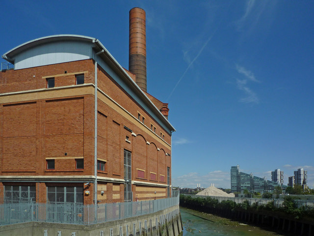
Image: © Ian Capper Taken: 6 May 2010
Looking down Chelsea Creek at low tide, with the former Lots Road Power Station on the left and the Montevetro development in Battersea Church Road in the distance on the right. In the centre, behind the heap of rubble, can be seen the chimneys of the Battersea Power Station.
Images are licensed for reuse under creativecommons.org/licenses/by-sa/2.0
Image Location


Leaflet Map data © OpenStreetMap
Latitude
51.477383
Longitude
-0.182179