Wainhouse Terrace
Introduction
The photograph on this page of Wainhouse Terrace by Alexander P Kapp as part of the Geograph project.
The Geograph project started in 2005 with the aim of publishing, organising and preserving representative images for every square kilometre of Great Britain, Ireland and the Isle of Man.

There are currently over 7.5m images from over 14,400 individuals and you can help contribute to the project by visiting https://www.geograph.org.uk
Wainhouse Terrace
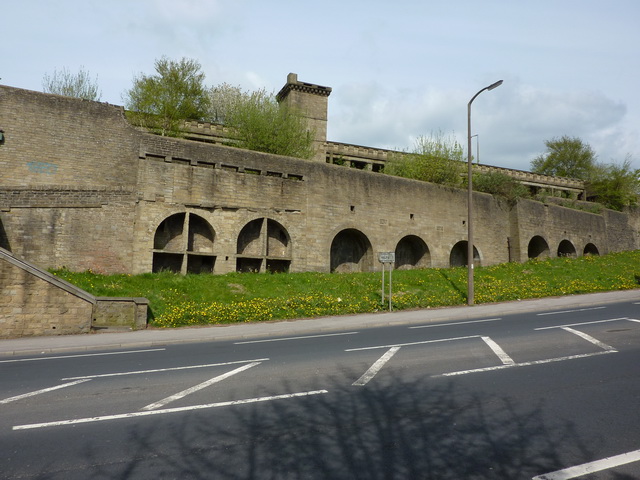
Image: © Alexander P Kapp Taken: 7 May 2010
The back-to-back houses built in the late 1800s by Edward Wainhouse were pulled down by the council in 1978.All that remains is the basements and a 200ft ornate terrace with panoramic views of the Calder Valley.
Images are licensed for reuse under creativecommons.org/licenses/by-sa/2.0
Image Location


Leaflet Map data © OpenStreetMap
Latitude
53.714073
Longitude
-1.885417