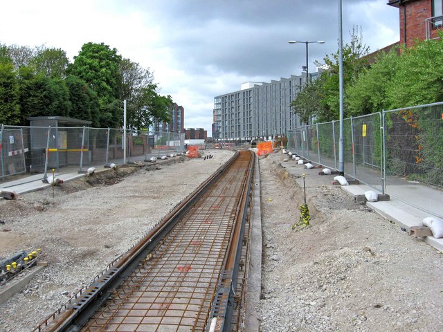
Manchester Metrolink construction near Merrill Street
Introduction
The photograph on this page of Manchester Metrolink construction near Merrill Street by P L Chadwick as part of the Geograph project.
The Geograph project started in 2005 with the aim of publishing, organising and preserving representative images for every square kilometre of Great Britain, Ireland and the Isle of Man.
There are currently over 7.5m images from over 14,400 individuals and you can help contribute to the project by visiting https://www.geograph.org.uk

Image: © P L Chadwick Taken: 2 May 2010
Between Piccadilly Railway Station and Merrill Street, the new line to Droylsden & Ashton-under-Lyne will be on reserved track, free of other traffic. This section is looking in the direction of Munday Street. The line will cross that street, and there will be a tram stop on the Piccadilly side of Munday Street. This stop will be known as New Islington. That is the name applied to this much redeveloped area, which no doubt will still be known to many as Ancoats. When this photograph was taken in early May 2010, only one line of rail had been laid at this point. A second will run alongside it. Image

