High Street, Skegness
Introduction
The photograph on this page of High Street, Skegness by Dave Hitchborne as part of the Geograph project.
The Geograph project started in 2005 with the aim of publishing, organising and preserving representative images for every square kilometre of Great Britain, Ireland and the Isle of Man.

There are currently over 7.5m images from over 14,400 individuals and you can help contribute to the project by visiting https://www.geograph.org.uk
High Street, Skegness
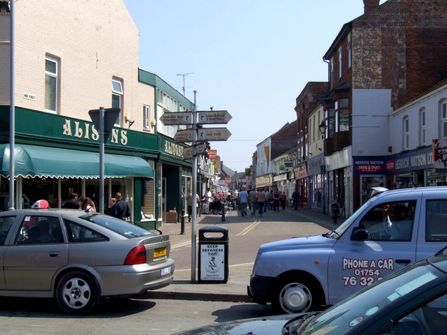
Image: © Dave Hitchborne Taken: 8 May 2008
Straight ahead to salvation and the beach. About half way down the street is Sally's Army, with a Christian Bookshop and Café across the road. There are several fish and chip shops and that is why this is more commonly known as "Chip Alley". There is also a model toy shop, a cycle shop, several gift shops, amusement arcade and more besides. The street sign indicates Roman Bank shops and post office, Lumley Road shops and Natureland, to the left. Straight on for High Street and the hotels. Right to Leisure Complex and Indoor Pool, Coach Station, Railway Station and Church Farm Museum. In the foreground is the Taxi rank.
Images are licensed for reuse under creativecommons.org/licenses/by-sa/2.0
Image Location
Latitude
53.143379
Longitude
0.335554