View over Dartmouth
Introduction
The photograph on this page of View over Dartmouth by Robin Drayton as part of the Geograph project.
The Geograph project started in 2005 with the aim of publishing, organising and preserving representative images for every square kilometre of Great Britain, Ireland and the Isle of Man.

There are currently over 7.5m images from over 14,400 individuals and you can help contribute to the project by visiting https://www.geograph.org.uk
View over Dartmouth
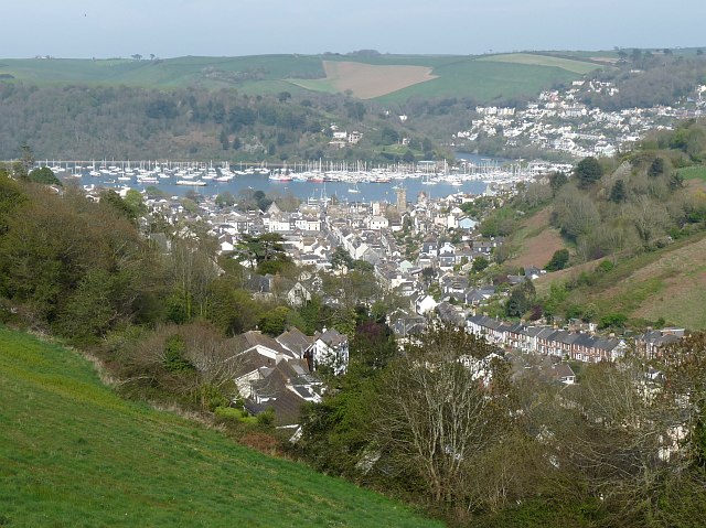
Image: © Robin Drayton Taken: 28 Apr 2010
Taken from Yorke Road (A379) near the junction with Townstal Road (A3122). Prominent is the tower of St Saviour's Church with the River Dart beyond. Part of Kingswear can be seen at the upper right.
Images are licensed for reuse under creativecommons.org/licenses/by-sa/2.0
Image Location
Latitude
50.350076
Longitude
-3.592031