Road to Nantmor Station, Gwynedd
Introduction
The photograph on this page of Road to Nantmor Station, Gwynedd by Peter Trimming as part of the Geograph project.
The Geograph project started in 2005 with the aim of publishing, organising and preserving representative images for every square kilometre of Great Britain, Ireland and the Isle of Man.

There are currently over 7.5m images from over 14,400 individuals and you can help contribute to the project by visiting https://www.geograph.org.uk
Road to Nantmor Station, Gwynedd
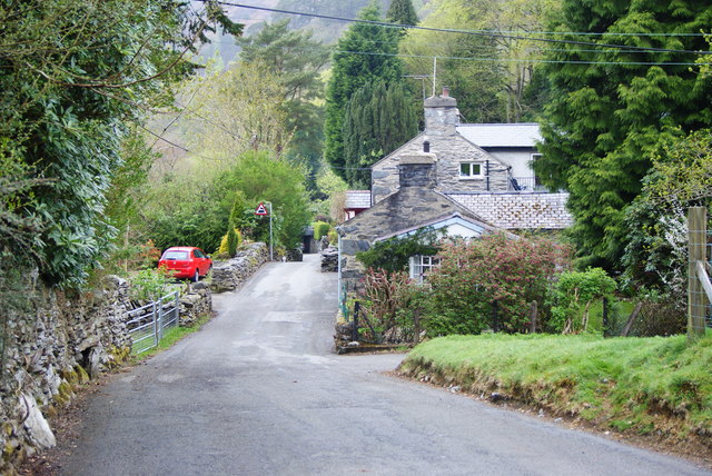
Image: © Peter Trimming Taken: 29 Apr 2010
The sign, for the level crossing, can be seen towards the centre of picture. The halt, at Nantmor, is scheduled to see a regular train service, on the Welsh Highland Railway, from late May 2010. Note; the first cottage, to the right of picture, marks the end of this grid square.
Images are licensed for reuse under creativecommons.org/licenses/by-sa/2.0
Image Location


Leaflet Map data © OpenStreetMap
Latitude
52.993259
Longitude
-4.086858