Stow Well [1]
Introduction
The photograph on this page of Stow Well [1] by Michael Dibb as part of the Geograph project.
The Geograph project started in 2005 with the aim of publishing, organising and preserving representative images for every square kilometre of Great Britain, Ireland and the Isle of Man.

There are currently over 7.5m images from over 14,400 individuals and you can help contribute to the project by visiting https://www.geograph.org.uk
Stow Well [1]
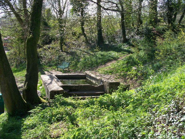
Image: © Michael Dibb Taken: 21 Apr 2010
Know as Stow Well, there are actually two wells. Stow was, until recent times, supplied with water from springs below the town. Two of these springs, which have never dried up, were made into wells and this is the larger. This was the towns main water supply until 1937.
Images are licensed for reuse under creativecommons.org/licenses/by-sa/2.0
Image Location


Leaflet Map data © OpenStreetMap
Latitude
51.933433
Longitude
-1.71808