Seer Green and Jordans railway station
Introduction
The photograph on this page of Seer Green and Jordans railway station by Nigel Cox as part of the Geograph project.
The Geograph project started in 2005 with the aim of publishing, organising and preserving representative images for every square kilometre of Great Britain, Ireland and the Isle of Man.

There are currently over 7.5m images from over 14,400 individuals and you can help contribute to the project by visiting https://www.geograph.org.uk
Seer Green and Jordans railway station
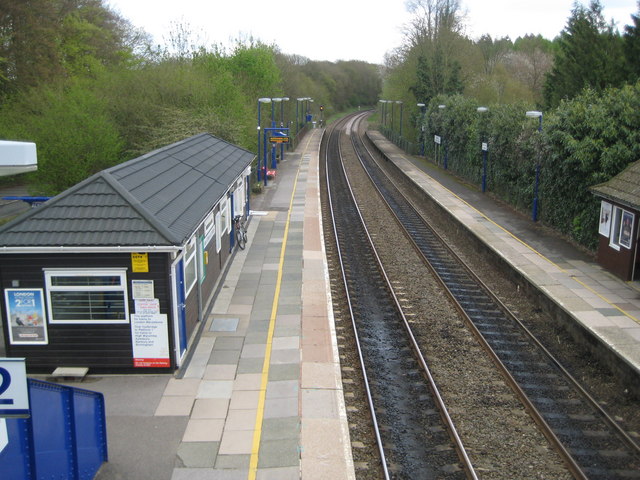
Image: © Nigel Cox Taken: 25 Apr 2010
This station had its origins in the agreement that allowed the Great Western Railway and the Great Central Railway joint venture London to Birmingham line to pass through the Wilton Park estate near Beaconsfield. The owner of the estate, Colonel William du Pre, insisted that a halt be built adjacent to the golf course on the estate that he had just commissioned. The station duly opened in 1915 as Beaconsfield Golf Links halt, although the 1925 Ordnance Survey map shows it as Seer Green Halt. It was later rebranded to its current name to reflect its service to the two communities. This is the view from the footbridge.
Images are licensed for reuse under creativecommons.org/licenses/by-sa/2.0
Image Location
Latitude
51.609751
Longitude
-0.607677