Former Rupert Stanley College, Belfast
Introduction
The photograph on this page of Former Rupert Stanley College, Belfast by Albert Bridge as part of the Geograph project.
The Geograph project started in 2005 with the aim of publishing, organising and preserving representative images for every square kilometre of Great Britain, Ireland and the Isle of Man.

There are currently over 7.5m images from over 14,400 individuals and you can help contribute to the project by visiting https://www.geograph.org.uk
Former Rupert Stanley College, Belfast
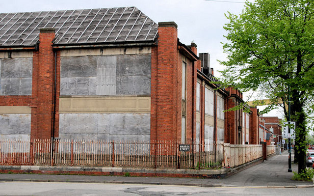
Image: © Albert Bridge Taken: 2 May 2010
Built in 1924 as a primary school, to a design by W.G. Davies and later used as a college of further education before being replaced by the present building in Tower Street Image Now disused, blocked up and minus some slates. In Templemore Avenue at the corner of Madrid Street (foreground). On the “at risk register”. Note added 20 August 2010 – there is now planning permission for “Restoration of the former Rupert Stanley college as a Community Networking Centre including offices, meeting rooms, multi-purpose hall, a cafe, a creche/daycare centre and support facilities." Image shows the renovation and conversion work in October 2012.
Images are licensed for reuse under creativecommons.org/licenses/by-sa/2.0
Image Location
Latitude
54.597373
Longitude
-5.901752