Site of Blunsdon Station
Introduction
The photograph on this page of Site of Blunsdon Station by Ben Brooksbank as part of the Geograph project.
The Geograph project started in 2005 with the aim of publishing, organising and preserving representative images for every square kilometre of Great Britain, Ireland and the Isle of Man.

There are currently over 7.5m images from over 14,400 individuals and you can help contribute to the project by visiting https://www.geograph.org.uk
Site of Blunsdon Station
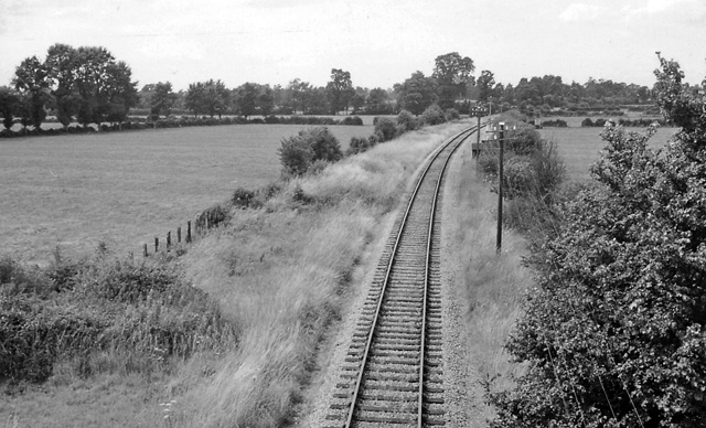
Image: © Ben Brooksbank Taken: 15 Jul 1961
View northward, towards Cricklade, Cirencester and Cheltenham; ex-M&SW Joint Cheltenham - Cirencester - Swindon - Marlborough - Andover Junction line, closed 11/9/61: this station was closed much earlier (28/9/24 to passengers, 1/8/37 to goods). Now, however, it is the centre of the Heritage Swindon & Cricklade Railway, established 1978.
Images are licensed for reuse under creativecommons.org/licenses/by-sa/2.0
Image Location
Latitude
51.607022
Longitude
-1.843856