Lane junction on the Quantocks
Introduction
The photograph on this page of Lane junction on the Quantocks by Derek Harper as part of the Geograph project.
The Geograph project started in 2005 with the aim of publishing, organising and preserving representative images for every square kilometre of Great Britain, Ireland and the Isle of Man.

There are currently over 7.5m images from over 14,400 individuals and you can help contribute to the project by visiting https://www.geograph.org.uk
Lane junction on the Quantocks
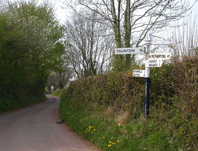
Image: © Derek Harper Taken: 24 Apr 2010
The finger post has four arms, but there are only three lanes at this junction at the top of Shellthorn Hill. Probably the fourth indicates the choice available at Image, which is 350 metres away. The lane ahead follows the ridge towards Merridge.
Images are licensed for reuse under creativecommons.org/licenses/by-sa/2.0
Image Location


Leaflet Map data © OpenStreetMap
Latitude
51.088449
Longitude
-3.088656