Former British Gas Engineering Research Station, Killingworth
Introduction
The photograph on this page of Former British Gas Engineering Research Station, Killingworth by Andrew Curtis as part of the Geograph project.
The Geograph project started in 2005 with the aim of publishing, organising and preserving representative images for every square kilometre of Great Britain, Ireland and the Isle of Man.

There are currently over 7.5m images from over 14,400 individuals and you can help contribute to the project by visiting https://www.geograph.org.uk
Former British Gas Engineering Research Station, Killingworth
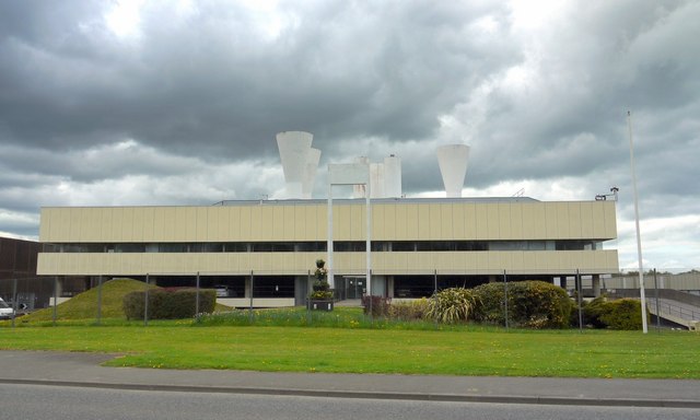
Image: © Andrew Curtis Taken: 29 Apr 2010
Designed in 1967 by architect Peter Yates http://en.wikipedia.org/wiki/Peter_Yates,_artist_and_architect of the Newcastle partnership, Ryder & Yates. Discussion of the architecture of this building with its dramatic roof elements Image can be found here http://www.c20society.org.uk/botm/archive/2004/engineering-research-station-killingworth.html It is a listed building now occupied by the Planning Department of North Tyneside Council.
Images are licensed for reuse under creativecommons.org/licenses/by-sa/2.0
Image Location
Latitude
55.036487
Longitude
-1.581114