Grange Farm and a field of oilseed rape, Bourton
Introduction
The photograph on this page of Grange Farm and a field of oilseed rape, Bourton by Brian Robert Marshall as part of the Geograph project.
The Geograph project started in 2005 with the aim of publishing, organising and preserving representative images for every square kilometre of Great Britain, Ireland and the Isle of Man.

There are currently over 7.5m images from over 14,400 individuals and you can help contribute to the project by visiting https://www.geograph.org.uk
Grange Farm and a field of oilseed rape, Bourton
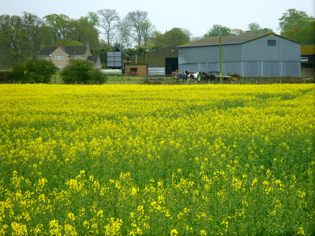
Image: © Brian Robert Marshall Taken: 29 Apr 2010
This is an attempt to find a bit of colour on a grey day. The crop, a member of the brassica family, hasn't quite reached its peak of eye-searing yellowness. Grange Farm, in the background, is on the far side of the London to the west railway hidden in a cutting. The horses visible here were a bonus.
Images are licensed for reuse under creativecommons.org/licenses/by-sa/2.0
Image Location
Latitude
51.585267
Longitude
-1.671454