The changing face of Stafford (continued)
Introduction
The photograph on this page of The changing face of Stafford (continued) by Simon Huguet as part of the Geograph project.
The Geograph project started in 2005 with the aim of publishing, organising and preserving representative images for every square kilometre of Great Britain, Ireland and the Isle of Man.

There are currently over 7.5m images from over 14,400 individuals and you can help contribute to the project by visiting https://www.geograph.org.uk
The changing face of Stafford (continued)
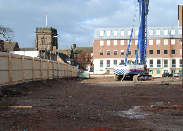
Image: © Simon Huguet Taken: 17 Jan 2010
17 January 2010 and the archaeologists have finished work and piling is underway on the new County Council development. The machine is parked in what was once the garden of St Chad's vicarage. The ancient church of St Chad's is clearly visible - at least temporarily.
Images are licensed for reuse under creativecommons.org/licenses/by-sa/2.0
Image Location
Latitude
52.805665
Longitude
-2.115959