Spring Terrace, Stainland
Introduction
The photograph on this page of Spring Terrace, Stainland by Humphrey Bolton as part of the Geograph project.
The Geograph project started in 2005 with the aim of publishing, organising and preserving representative images for every square kilometre of Great Britain, Ireland and the Isle of Man.

There are currently over 7.5m images from over 14,400 individuals and you can help contribute to the project by visiting https://www.geograph.org.uk
Spring Terrace, Stainland
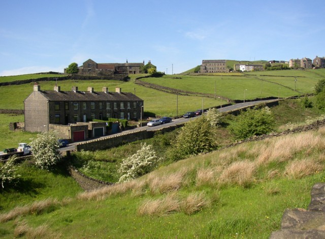
Image: © Humphrey Bolton Taken: 2 Jun 2006
This is a view of the western end of Stainland village. Spring Terrace is a row of houses looking rather urban for this situation. Behind it is Higher New Yard, the farmhouse of which was built in late 17C or early 18C and extended in the early 19C (closer photo: http://www.imagesofengland.org.uk/images/33/84/L338453.jpg ). To the right of this is Providence Chapel, built with two-storey dwellings beneath.
Images are licensed for reuse under creativecommons.org/licenses/by-sa/2.0
Image Location
Latitude
53.666532
Longitude
-1.892507