The ancient causeway and its bridge
Introduction
The photograph on this page of The ancient causeway and its bridge by Natasha Ceridwen de Chroustchoff as part of the Geograph project.
The Geograph project started in 2005 with the aim of publishing, organising and preserving representative images for every square kilometre of Great Britain, Ireland and the Isle of Man.

There are currently over 7.5m images from over 14,400 individuals and you can help contribute to the project by visiting https://www.geograph.org.uk
The ancient causeway and its bridge
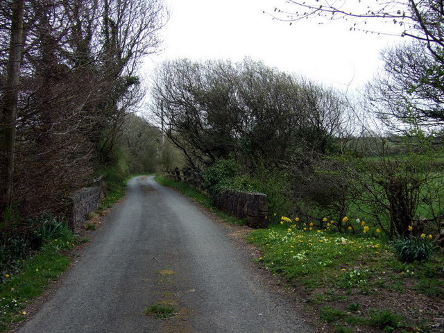
Image: © Natasha Ceridwen de Chroustchoff Taken: 28 Apr 2010
Now a minor road that links the A40 with Mathry and the road to St David's, this was formerly a raised causeway, possibly of Neolithic date, across the boggy valley of the upper Cleddau. As explained by Damien Walford Davies and Anne Eastham in their book 'Saints and Stones', Gomer, 2002, "The causeway is constructed of huge Preseli boulders, interlocking with each other and rising and falling with the water levels in the marsh or lake bed beneath....In 4000 years or so of use, smaller stones and layers of water macadam have been added by generations of road menders to build up the carriageway,until in the 19th century culm and rubble with fragments of pottery became incorporated in the fill and parapets were added" to the bridge.
Images are licensed for reuse under creativecommons.org/licenses/by-sa/2.0
Image Location


Leaflet Map data © OpenStreetMap
Latitude
51.958669
Longitude
-4.992315