Ancient bridge over the Cleddau
Introduction
The photograph on this page of Ancient bridge over the Cleddau by Natasha Ceridwen de Chroustchoff as part of the Geograph project.
The Geograph project started in 2005 with the aim of publishing, organising and preserving representative images for every square kilometre of Great Britain, Ireland and the Isle of Man.

There are currently over 7.5m images from over 14,400 individuals and you can help contribute to the project by visiting https://www.geograph.org.uk
Ancient bridge over the Cleddau
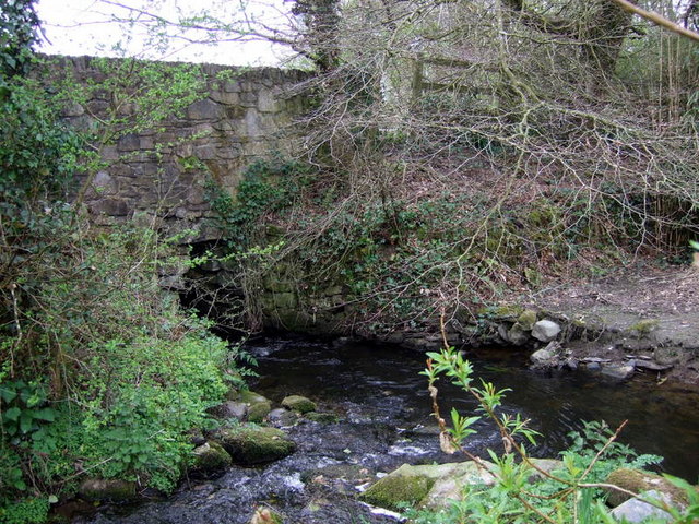
Image: © Natasha Ceridwen de Chroustchoff Taken: 28 Apr 2010
Easily missed tiny arch constructed of huge stones. It carried what was once a raised causeway across the young river Cleddau Wen and its surrounding bog, later part of the pilgrim route to St David's although it is thought this bridge may date back to prehistoric times. "The bridge is of corbelled construction with 9 capstones, each measuring over 2 metres in length." (See 'Saints and Stones' by Damien Walford Davies and Anne Eastham, Gomer, 2002) The river is flowing from the right in the image, and joined by a stream from the left.
Images are licensed for reuse under creativecommons.org/licenses/by-sa/2.0
Image Location


Leaflet Map data © OpenStreetMap
Latitude
51.958938
Longitude
-4.992333